Vacuumformed
Vacuumformed technique
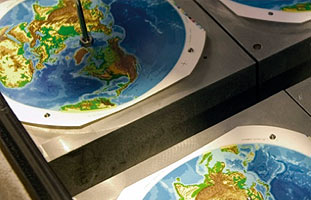
The so-called vacuumformed technique is used to produce our mechanically made globes. That means that first a distorted map is printed which then is smoothed out in a second production step. The northern and the southern hemisphere of our acryl globes are produced separately and merged later on. This technique is well-proven and is used by COLUMBUS since 1965. The globes made that way are available with DUPLEX®, PANORAMA™ - and RENAISSANCE™ maps.
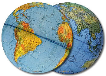
Columbus DUPLEX | illuminated physical map / non illuminated political map
With the innovative dual map technology, you can view political borders in contrasting colors when the globe is turned off, and physical features when the light is switched on. An unparalleled level of detail is put into the cartography work making this an ideal reference globe. The 16 layers printing that make up the map and its place-names are printed on special durable material that will never wear off from the acrylic ball. Each globe comes with a booklet. The political map (non-illuminated globe), informs about the borders between the different states on earth using contrasting but harmonious colors. The physical map (illuminated globe) shows the physical environment complete with its mountainous regions, low- and high-lands, deserts and ocean-depths in a finely graduated color grading scheme.
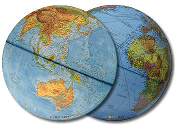
Columbus PANORAMA | non illuminated vegetationszones and illuminated the political
Panorama - shows non illuminated vegetationszones and illuminated the political view of our earth With the innovative dual map technology, you can view political borders in contrasting colors when the globe is turned on, and physical features when the light is switched off. An unparalleled level of detail is put into the cartography work making this an ideal reference globe. The 18 layers printing that make up the map and its place-names are printed on special durable material that will never wear off from the acrylic ball. Each globe comes with a booklet. The PANORMA globe allows us to take a new and unique view on our planet. The non-illuminated globe shows us mountainous massifs, valleys, the ocean relief, the vegetation cover and much more in unexpected vividness. When illuminated, the political map of our world appears in the accustomed quality.
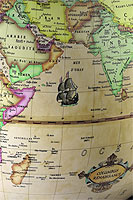
Columbus RENAISSANCE | Map - non-illuminated political/ illuminated historical
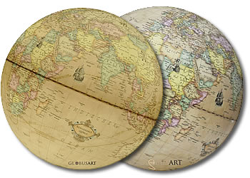
The RENAISSANCE map is based on historical maps from the 16th century. Its discreet coloring and nostalgic details emanate a feeling of warmth and harmony. The globe shows the contemporary political map. The RENAISSANCE globe is characterized by parchment colored oceans, countries rendered by outlines, and beautiful details such as frigates, naval battles and a compass rose. In addition, the historic routes of the great discoverers Columbus and Magellan become visible when switching on the globe.